"That's crazy! How did I not know that??"
That was the reaction I got from a friend when I switched into Google Maps 3D mode. If you've seen it before, it's all very straightforward and obvious, but as I learned from my friend, not everyone knows how to do this!
It's actually very easy.
To switch into 3D ("flying around") mode do this:
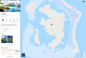
1. Search for your place (in the image below, I searched for the island of Bora Bora in French Polynesia):

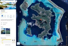
2. Switch to Satellite mode by clicking on the Satellite icon in the lower left corner of the map:

3. Click on the 3D button on the lower right corner of the satellite image. You can then zoom in/out with the + / - buttons in the lower right, or use a two-finger pinch-to-zoom gesture on a touchpad. (The scroll wheel on a trad mouse works too.)
4. To move around... that is, to change your point-of-view, you use:
Control+long-press on the mouse and
drag the mouse around
drag the mouse around
while pressing the button
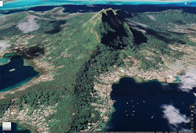
That's how I got to this view of Bora Bora.

Notice that I closed the left-hand panel by clicking on the leftward pointing triangle (just to the right of the search bar), and then made the labels disappear by clicking on the 3 lines in the upper left corner of the search panel (to the left of the search box). This is called the "hamburger" menu, and will look like this when you click on it:
Then you can click on the "Labels on" item, which will toggle the labels on/off. (I know this isn't obvious, but now you know how.)
I also made a short video about how to do this.
https://youtu.be/rMRAL6dvvK0
Hope you find this helpful!
Search on.

No comments:
Post a Comment