
It was fairly distressing. Why could I NOT fly through 3D landscapes using Google Maps?
As you probably know, IF you're in Google Maps with Satellite view turned on (that is, you can see the ground, trees, buildings) AND you hold down the control-key, THEN by moving your mouse around, you can fly through the landscape.
At least, until you suddenly can't do this one day.
I kept searching around for the answer, and managed to figure it out (no help from various online documentation!).
The answer: You have to turn on the "Globe View" setting on Maps. Mine was turned off, which is why I couldn't fly around. (No, I don't know how it got turned off.)
You'll find the options control in the lower left of the Maps display. Looks like this:

Click on the "Layers" button in the lower left. It should change to look like this:

When you hover over the Layers button, you should see more options to the right:
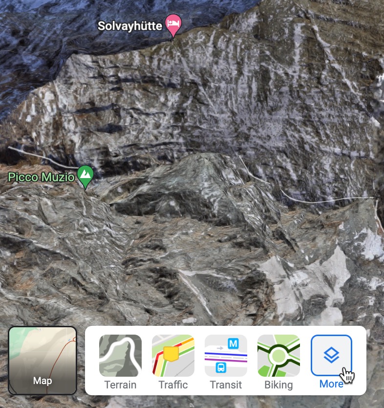
Click on "More" to see the suboptions, including other views (Transit, Traffic, Biking, etc.) along with "Globe View" and "Labels."

This shows the submenu with Map Details.
If you want to fly, turn on "Globe view" so that the checkbox is marked (as above). Once that's checked, you can fly around.
And, for extra fun, you can turn off "Labels" if you want to see your map without all of the annoying labels that tell you every street, building, and business name in the view satellite view. Annoyingly, you can't turn them on/off in maps view, but so it goes. Here's the difference:


If you'd like a short video, here's one showing the way to turn Globe View on.
Enjoy!
I can turn labels on and off, but can't get global view/fly mode… must be other inhibitors, but interesting post… usually only look for map type, but don't explore past that… focus diluter…
ReplyDeleteInteresting! Mac or PC? Latest OS? Latest Chrome? etc.
Deleteboth a Mac & a Chromebook - both ancient - non-update-able - that is probably the rub - no flying for me... probably couldn't handle the 'horn's crosswinds
Deletealmost like flying -
https://www.summitpost.org/solvay-hut/274885
Hi there.
ReplyDeleteJust a side comment: globe view not always show the last imagery, mostly on cities. Note this if you are searching on time dependant details.
Interesting... do you have a place that doesn't show the Globe view? (Give us a place name or a Lat/Long!)
DeleteIt works for me. Here's a picture of that location from a 45 degree view. View of the launch site from over the water.
ReplyDeleteNow I see what you mean. That's correct--different parts of Maps have images from different times. That includes images from Maps with Globe View vs. non-Globe View. I agree it's outdated, but that's sometimes an advantage. With different images from different times, you can get a before/after view. It's a pity that they don't publish the ACTUAL time/date stamp on the image. That would be incredibly useful.
ReplyDeleteTotally agree!
ReplyDelete"Outdated" in this case, and many more, can be read as "more information available" but it's important to be aware of to check both versions and don't keep sticking to globe view and taking that info as the last info available because not necessarily it is ;-)