Photos from the heavens...
 |
| Early aerial photo by Gaspard-Félix Tournachon, aka Nadar, from a hot air balloon. Near Montmartre, Paris, 1866. P/C Wikimedia. |
In my searches this week I found, as Howard Carter said when peering into Tut's tomb for the first time, "... I see marvelous things," including this shot of the pyramids at Giza, photographed from Eduard Spelterini's balloon on November 21, 1904.
 |
| Giza Pyramid complex. Eduard Spelterini, 1904. Wikimedia. |
A little background: The first aerial photograph is widely considered to be one taken in 1858 by French photographer and balloonist Gaspard-Félix Tournachon, also known as "Nadar". Nadar took the photo from a tethered hot-air balloon 80 meters above the French village of Petit-Becetre, took eight separate images on a glass plate negative. Unfortunately, his original photographs are long gone, so the earliest surviving aerial photograph was taken by James Wallace Black in Boston, 1860. He caught a ride in Samuel Archer King's hot-air balloon, the "Queen of the Air" while it was tethered at Boston Common.
I bring this up because it was really hard to get decent aerial photos before 1900. There were some photos taken from kites, blimps, and even pigeons, but not many, and mostly made for specific purposes.
 |
| Julius Neubronner, Die Brieftaube als Photograph, in: Die Umschau, JG 12, Nr 41, 1920. Link. |
For even more fun background information, see the Wikipedia article on Aerial Photography. Aerial images made in these very early days are widely available and often spectacular, but they're not collected anywhere in particular--it's just sort of hodge-podge. Search for your location / subject + aerial photography (maybe add in "kite" or "pigeon" or "balloon" into the search). But don't spend a lot of time on this--the number of images is small.
It wasn’t until the First World War that aerial photography took off (so to speak), with commercial photography services springing up. The best known in the US was Fairchild Aerial Surveys.
Meanwhile in the UK the big post-war aerial photo service was Aerofilms. (It’s changed hands a few times—the images are available at National Collection of Aerial Photography).
You can sometimes find the earliest images of a location by searching for a location + kite. When you do this for San Francisco, you'll end up finding the images immediately after the 1906 earthquake as seen from a kite flying over the east side of San Francisco. It's worth clicking on this image as it's pretty high res. (As a local, I can recognize many of the streets even now, 118 years later.)
 |
| Kite photo by George Lawrence of San Francisco after the earthquake of 1906. P/C Wikimedia |
I bring this all up because... knowing the history of aerial photography is important in finding the images. Most aerial images I’ve been able to find are in collections at libraries, archives, and museum. And most often, they’re organized by location AND by the company or organization that collected the image.
As my Maps Librarian friend Zoe wrote: “Aerial photography is sometimes publicly available, sometimes privately held or in copyright restriction. It can be indexed or preserved at the municipal, county, state level as well as other jurisdictions, as well as by land management agency in the case of state, federal, and tribal lands.”
That caution of "sometimes" available is really true. Many collections require money, sometimes a LOT of money to access their pics.
With all that as warning, what CAN you do to find older aerial images?
To do a good search for OLDER aerial imagery, you’ll have to figure out WHERE you’ll want to look, WHEN you want to look, what ORGANIZATION holds the images, and the NAME of the outfit that created (or collected) the images.
For instance, at Airphotos you’ll find the Benjamin and Gladys Thomas Air Photo Archives at the UCLA Department of Geography. This includes images from the Spence Collection and the Fairchild Collections. The Spence Collection is from Spence Air Photos, Inc. – All oblique low altitude black and white aerial photographs taken between the years 1918-1971. The Fairchild photos are all from Southern California taken between 1927 and 1964. The collection is huge, but most of it requires that you pay $80/hour if you ask them to do the research, or $40/hour if you visit in person. The biggest problem is that they don't really have overview images, so you can't really see what you're going to get. Great collection, but not exactly handy.
There’s also the Hatfield Aerial Surveys, available through the Online Archive of California (and the Stanford Archives - and a guide to searching the Stanford Archives). They're mostly aerial photographs of the Stanford University campus and Palo Alto. They're useful to me, but probably not to anyone outside of the 94304 Zip Code.
The point here is that you should try to search in an area, discover what collections exist AND who made them, then search for that collection by name.
For example, to find archival aerial photos of Rochester, NY (where I went to graduate school), I searched for:
[ Rochester NY aerial photograph ]
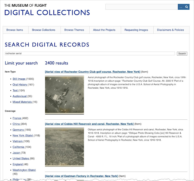
which led me to learn about the USA School of Aerial Photography, now collected at the Museum of Flight Digital Collections. Once there, I could use the search tool on their website [Rochester aerial photograph] and find a nice set of images. The same trick will probably work for your location.
 |
| Sample of the Museum of Flight Digital Collections |
 |
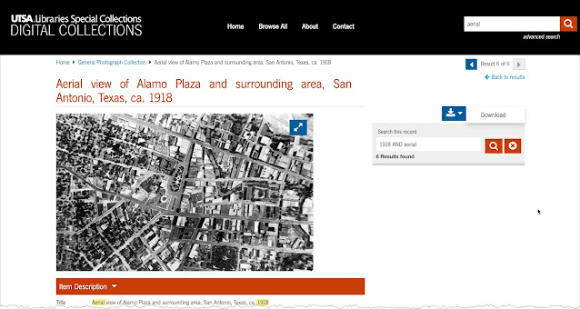
| Aerial View of Alamo Plaza San Antonio, General Photograph Collection, 083-1019, UTSA Special Collections |
*
What about the more general case? Here's a listing of some of the US nation-wide collections you might consider:
USGS Earth Explorer: The U.S. Geological Survey (USGS) provides access to satellite and aerial images of various areas. It's especially useful for historical aerial photography. (However... Difficult to use. Often you can find the image metadata, but then you have to go elsewhere to actually download or purchase the images.)
OpenAerialMap: A platform that offers free and open access to a variety of aerial imagery collected from different sources. (But really spotty coverage. Very little in my area.)
Historic Aerials: Good collection, but very similar to Google Earth's archive image function. Costs money (and has annoying ads).
Google Earth: There is a web version of Earth, but the application is MUCH better. It's very easy to look back in time. Here are the Google Earth images of Montmartre from 1949 and 2023. Contrast these with the photo at the top of the post taken by balloon in 1866.
SearchResearch Lessons
When you're searching for archival aerial images, there are a few things to keep in mind...
1. Not everything is online--Trust me on this. A LOT of archival images are still stashed away in archive and library collections. You might have to physically visit the collection in order to find what you really need. Don't pass up the chance to visit the archive in person. (You cannot believe the things I've found just because I was there. The number of times an archivist has said to me "this isn't cataloged yet, but I think you'll find it interesting" is amazing. Don't miss the chance to visit!
2. Images are often in collections, but often NOT in the collection you might expect. I managed to find a bunch of great aerials of San Francisco from the 1920s... in the collection of the University of Nebraska. Keep your search broad and run down all of those leads. You never know when you'll find the aerial image you want.
3. When doing image searches, switch to black-and-white mode when you can. That often helps limit your searches to early images.
4. Call the librarian or archivist! Really! I made about a dozen calls when researching this post, and uniformly, they answered the phone (or actually called back). Real humans are a great resource, especially as they can translate what you really meant to say into a working search.
Keep searching!


I'm wondering why you didn't add something in the query about the past [Rochester NY aerial photograph ]
ReplyDeleteSearched for Puebla and found this:
..."En una de las publicaciones, por ejemplo, señalan que la Compañía Mexicana Aerofoto fue una empresa especializada en la fotografía aérea que retrató la República Mexicana y algunos países de América Latina..."
I wonder what happened to those photographies
https://www.eluniversalpuebla.com.mx/viral/asi-era-el-google-maps-del-siglo-pasado-en-puebla/
Searched for [aerofoto] I thought I'd need to add Luis Struck
http://www.fundacion-ica.org.mx/nuestro_acervo